RoadsideThoughts
A Gazetteer for the United States and Canada
Home >> State of Kansas >> Butler County >> El Dorado >> SummaryIndex...


Learn About
The Commemorative
Quarter for
Kansas


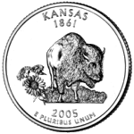
The Commemorative Quarter for Kansas


Summary for El Dorado


About El Dorado (Click for our profile page)

Located in: Butler County (see below)

Time Zone: El Dorado lies in the Central Time Zone (CST/CDT)

Telephone Area Code: (316)

ZIP Code: 67042<1>

Elevation: 1,330 feet [405.38 m] above sea level<2>

From the 2010 US Census     (For more detail, see our Census Page for El Dorado)

Population

YearPopulation
2019 Est:<3>     12,949   (0.55% decrease since 2010)  
2010:     13,021   (8% increase since 2000)
2000:     12,057

Total Area:<4>   8.92 sq. miles [23.1 km²]

Housing Units:<5>   5,797

Websites for El Dorado

Official Website:   www.eldoks.com/

Chamber of Commerce:   www.eldoradochamber.com/

GPS Coordinates (Latitude/Longitude)<6>

For the purpose of mapping and calculating distances, we have chosen the following reference point for El Dorado:

Lat:   37.817500°   (or 37°49'3" N)

Lon:   -96.860900°   (or -96°51'39" W)

USGS Topo Map:   El Dorado<7>

Federal GNIS/FIPS Codes for El Dorado

GNIS ID:   485567

FIPS State / Place Code:   20 / 20075

(For more about Federal Codes, see our Misc Page for El Dorado)


About Butler County

The city of El Dorado is the County Seat for Butler County.

From the 2010 US Census     (For more detail, see our Census Page for Butler)

Population

YearPopulation
2019 Est:     66,932   (1.6% increase since 2010)  
2010     65,880   (10.76% increase since 2000)
2000:     59,482

Total Area:   1,446 sq. miles [3,746.5 km²]   - of which 1.15% is water (16.66 sq. miles [43.2 km²])

Housing Units:   26,058

Official Website:   www.bucoks.com/

Federal GNIS/FIPS Codes for Butler

GNIS ID:   484977

FIPS State / County Code:   20 / 015

(For more about Federal Codes, see our Misc Page for El Dorado)


About Kansas

From the US Census

Population

YearPopulation
2019 Est:     2,912,635   (2.09% increase since 2010)  
2010:     2,853,118   (6.13% increase since 2000)
2000:     2,688,418

Websites for State of Kansas

Official Website:   https://portal.kansas.gov/

Tourism:   https://ksoutdoors.com/

Parks:   https://ksoutdoors.com/State-Parks/

Fishing:   https://ksoutdoors.com/Fishing/

Hunting:   https://ksoutdoors.com/Hunting/

Federal GNIS/FIPS Codes for State of Kansas

GNIS ID:   481813

FIPS State:   20

(For more about Federal Codes, see our Misc Page for El Dorado)

The official website for El Dorado: www.eldoks.com/

The official website for Butler County: www.bucoks.com/

The official website for State of Kansas: https://portal.kansas.gov/

Footnotes ...

<1>ZIP Codes have been created by the United States Postal Service (USPS) as a way of grouping addresses to make delivery more efficient. The boundaries of the ZIP Code can be changed, re-assigned, eliminated or overlapped with other ZIP Codes. So keep in mind that any given ZIP Code is only 'loosely' associated with a city (such as El Dorado). When looking for a ZIP Code, whether El Dorado or elsewhere, it's always best to check the website of the United States Postal Service (USPS).
<2>The elevation is an estimate for the area around El Dorado - it will be higher in some places and lower in others.
<3>Every year, the US Census Bureau creates a population estimate for the preceeding year. Keep in mind that this value is an estimate and not an actual count. The most recent Census estimate is for the year 2019.
<4>The area value has been supplied by the US Census Bureau and it can be different than the geographic boundaries of El Dorado. The value given by the Census Bureau reflects their statistical (or sampling) requirements. For example, if there is a cluster of people living just outside of the community's official boundary, the Census-defined area might be expanded to include that group.
<5>A Housing Unit is a broad term for those places where people live (whether occupied or temporarily vacant), such as a house, an apartment, a mobile home, or an area that is considered as a separate living quarter. Separate living quarters (consisting of one or more rooms) are considered to be those places where people live, sleep and eat separately from others and that have access to the outside (either directly or by a shared hallway).
<6>Longitude & latitude values may not be the geographic center of El Dorado, rather it may be a prominent intersection or the center of population, etc. It will vary depending on the source.
<7>Name of the USGS 7.5 Minute topographic map which includes El Dorado.


Copyright 2024
All Rights Reserved

Thank you for visiting our website.

In closing, please keep in mind that we can not guarantee the accuracy or timeliness of the information on this website, so use with care. We encourage you to double-check the information that is critical to you.

If you've found an error or have additional information that you would like to share, please don't hesitate to write: Click here to contact us.

This page was last modified/updated: 07 Apr 2024