RoadsideThoughts
A Gazetteer for the United States and Canada
Home >> State of Kentucky >> Rockcastle County >> Brodhead >> MentionsIndex...


Learn About
The Commemorative
Quarter for
Kentucky


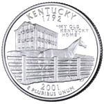
The Commemorative Quarter for Kentucky


Miscellaneous References and Mentions

While our initial information about Brodhead came from various goverment sources (GNIS, US Census, FIPS), we also found mention of Brodhead in various books, maps and other sources.

We've created the following list to keep track of the sources that proved useful in adding to our knowledge about Brodhead. We hope that they will be useful to you.

Note: Initially, we were careless about keeping track of where our Brodhead data came from. The following list of references and mentions is incomplete.


SPV's Comprehensive Railroad Atlas of North America - Appalachia & Piedmont
Written by: Walker, Mike
Published by Steam Powered Video (SPV), 2004
(Available from Amazon.com)

Rand McNally Map of Kentucky (1911)
Published by Rand McNally & Co.

Shell Oil Road Map for Kentucky (1956)
Published by Shell Oil Company

We found Brodhead in these Censuses: 2010-1990. See our Census Page for Brodhead for more information.

Both the GNIS and FIPS databases contain entries for Brodhead. See our Misc Page for Brodhead for more information.

Unfortunately, we don't know of a website for Brodhead. If you can help, please contact us through our Feedback Page.

The official website for State of Kentucky: https://kentucky.gov/


Copyright 2025
All Rights Reserved

Thank you for visiting our website.

In closing, please keep in mind that we can not guarantee the accuracy or timeliness of the information on this website, so use with care. We encourage you to double-check the information that is critical to you.

If you've found an error or have additional information that you would like to share, please don't hesitate to write: Click here to contact us.

This page was last modified/updated: 14 Apr 2025