Summary for Alewa Heights
About Alewa Heights (Click for our profile page)
Typical Abbreviation: Alewa Hts.
Time Zone: Alewa Heights lies in the Hawaiian/Aleutian Standard Time Zone (HST)
Telephone Area Code: (808)
Elevation: 770 feet [234.7 m] above sea level<1>
GPS Coordinates (Latitude/Longitude)<2>
For the purpose of mapping and calculating distances, we have chosen the following reference point for Alewa Heights:
Lat: 21.343100° (or 21°20'35" N)
Lon: -157.852800° (or -157°51'10" W)
USGS Topo Map: Honolulu<3>
Federal GNIS/FIPS Codes for Alewa Heights
GNIS ID: 358553
FIPS State / Place Code: 15 / 01750
(For more about Federal Codes, see our Misc Page for Alewa Heights)
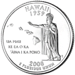
About Hawaii
From the US Census
Population
| Year | Population |
| 2019 Est:<4> | 1,415,615 (4.07% increase since 2010) |
| 2010: | 1,360,301 (12.28% increase since 2000) |
| 2000: | 1,211,537 |
Websites for State of Hawaii
Official Website: https://portal.ehawaii.gov/
Tourism: https://www.gohawaii.com/
Parks: http://dlnr.hawaii.gov/dsp/
Federal GNIS/FIPS Codes for State of Hawaii
GNIS ID: 1779782
FIPS State: 15
(For more about Federal Codes, see our Misc Page for Alewa Heights)
Off-the-Road Links ...
Unfortunately, we don't know of a website for Alewa Heights. If you can help, please contact us through our Feedback Page.
The official website for State of Hawaii: https://portal.ehawaii.gov/